
Land Surveying, Topographic Surveys & Construction Staking in Houston, TX
Accurate ground data before design, and accurate stakes during construction — so every crew that follows is building to the right line and the right elevation.
Every commercial project starts with a survey, and most of the expensive surprises on a site trace back to one. A topo that missed a drainage swale, a benchmark that was off by a tenth, a property corner nobody verified — each one turns up later as a redesign, a regrade or a building that sits a few inches somewhere it should not.
Our surveying scope covers the full life of a site: the topographic and boundary data a civil engineer designs from, the construction staking our crews and yours build to, and the as-built survey that closes the job out. Because we also self-perform site work, earthwork and concrete, we know exactly what a field crew needs from a survey, and we deliver it in a form they can use.
Surveys are run for commercial developers, owners, engineers and general contractors across Greater Houston and the Texas Gulf Coast — whether or not we build the rest of the project.
What's included
Pre-design surveys
- Topographic surveys with contours and spot elevations
- Boundary and property line surveys
- ALTA/NSPS land title surveys
- Tree, drainage and existing-feature surveys
- Easement and right-of-way exhibits
Construction staking & layout
- Survey control and benchmarks
- Building corners and pad layout
- Grade stakes for cut, fill and fine grading
- Water, sewer and storm line staking
- Curb, paving, canopy and sign foundation layout
Mapping & data
- Drone (UAV) aerial mapping and orthophotos
- Cut and fill / earthwork volume calculations
- Stockpile and progress quantity surveys
- Existing utility locating and mapping
- CAD surfaces and linework for design teams
Close-out
- As-built surveys of utilities and grading
- Detention pond as-builts and volume certification
- Elevation certificates and finished floor checks
- Final pad and foundation verification
- Record drawings for owners and jurisdictions
What a topographic survey actually tells you
A topographic survey maps the shape of the ground — contours, spot elevations, drainage paths — along with everything sitting on it: trees, pavement, structures, fences, visible utilities and the inverts of existing storm and sewer structures. It is the base the civil engineer designs grading, drainage, detention and utilities from.
On flat Gulf Coast ground that matters more, not less. Across much of Greater Houston a site may only fall a foot or two from one side to the other, which means a small error in the topo becomes a drainage design that does not work. Water that should leave the site ends up ponding against the building instead.
A good topo also saves money in the earthwork. Accurate existing grades are what make a credible cut/fill balance possible, and that balance is usually the largest single cost lever in a site package.
Boundary, topographic, ALTA and as-built: which survey you need
A boundary survey establishes where the property lines are. A topographic survey maps the ground and features within them. An ALTA/NSPS land title survey is the most comprehensive of the three — boundary, improvements, easements and title matters to a national standard — and is what lenders and title companies typically require on a commercial purchase or refinance.
Construction staking is a different kind of work entirely: transferring the approved plans onto the ground so crews can build to them. And an as-built survey closes the loop, recording what was actually installed — line locations, inverts, pond volumes, finished grades — for the owner, the engineer and the jurisdiction.
Most commercial sites need several of these over their life. Ordering them from the same team keeps a single control network from the first topo to the last as-built, so nothing gets lost translating between surveyors.
Staking from a contractor who also builds
Construction staking fails in small ways: offsets that do not suit the equipment, stakes knocked out a day before the crew gets to them, grades marked in a way the operator has to reinterpret. None of that shows up on the plans, but all of it costs time in the field.
Because our own crews build the utilities, pads and foundations we stake, layout is sequenced against the actual work. Stakes go in when the crew is ready for them, re-staking is handled in-house rather than waiting on an outside surveyor’s schedule, and any conflict between the plan and the ground is raised before anything is installed.
Drone mapping and earthwork volumes
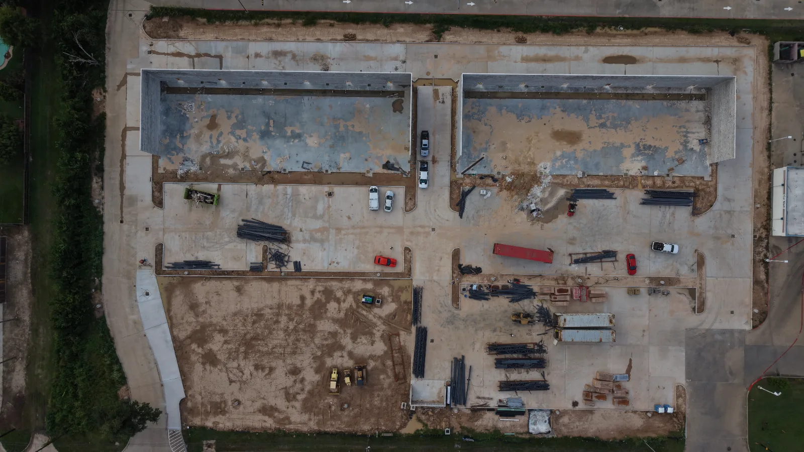
Aerial drone mapping captures a whole site in a single flight — useful for large or wooded tracts, progress documentation and stockpile volumes. Paired with ground control, it produces orthophotos and surfaces that design teams and estimators can work from.
It does not replace a ground survey where precision is critical. Property corners, utility inverts and finished floor elevations are still measured on the ground. Drone data is used where it is strongest, and the two are tied to the same control.
Our process
- Step 01
Scope & research
The survey type is matched to what the project needs, and existing deeds, plats, title commitments and utility records are pulled before anyone goes to the field.
- Step 02
Control
Horizontal and vertical control is established and tied to recognised datums, so every later survey and stake works from the same reference.
- Step 03
Field survey
Ground survey of corners, elevations, features and utility structures, supplemented by drone mapping where the site suits it.
- Step 04
Drafting & deliverables
CAD surfaces, linework and signed survey drawings prepared in the format the design team and jurisdiction need.
- Step 05
Construction staking
Lines and grades staked in sequence with the work, with re-staking handled quickly as crews advance.
- Step 06
As-built & close-out
Installed utilities, ponds and grades surveyed and recorded for the owner, the engineer and final acceptance.
Common questions
What is a topographic survey, and when do I need one?
A topographic survey maps the elevations and features of a site — contours, drainage, trees, structures and visible utilities. You need one before a civil engineer can design grading, drainage, detention or utilities, so it is usually one of the first things ordered on a commercial development.
What is the difference between a boundary survey and an ALTA survey?
A boundary survey locates the property lines. An ALTA/NSPS land title survey goes further, adding improvements, easements, access and title-commitment items to a national standard. Lenders and title companies usually require an ALTA on commercial transactions.
How long does a topographic survey take?
It depends on the size of the tract, the vegetation and how much detail the design needs. A typical commercial pad site is often turned around in one to three weeks, but we confirm a schedule once the scope is defined.
Who is allowed to perform land surveys in Texas?
Professional land surveying in Texas is regulated by the Texas Board of Professional Engineers and Land Surveyors (TBPELS). Boundary, ALTA and other sealed surveys must be performed under a Registered Professional Land Surveyor (RPLS) through a registered surveying firm. Licenses can be checked on the public TBPELS roster.
Can a drone survey replace a traditional ground survey?
Not entirely. Drone mapping is excellent for large sites, volumes and progress tracking, but property corners, utility inverts and critical elevations are still measured on the ground. We use both, tied to the same control.
Do you provide construction staking for projects you are not building?
Yes. Topographic surveys and construction staking are frequently contracted on their own by developers, engineers and other general contractors.
Related services
Site Work & Utilities
Water, sewer and storm, earthwork, detention, paving and fuel systems — the dirt-to-pad scope, self-performed.
Dirt Hauling & Earthwork
Fleet-backed hauling, cut and fill, and material supply — with the trucks we own, on the schedule we set.
Design-Build
One contract from concept to keys — civil engineering, permitting, estimating and value engineering under one roof.
Need surveying & topography in Houston?
Tell us about the project and we'll come back with a real scope and a real number.